- Drone class B - DJI Mavic, Phantom o simili
- Model DJI Phantom 4
- Location Canton Ticino
- Flight time 2 hour
- Post-production 48 hour
Customer
Surveyor Study
Problem
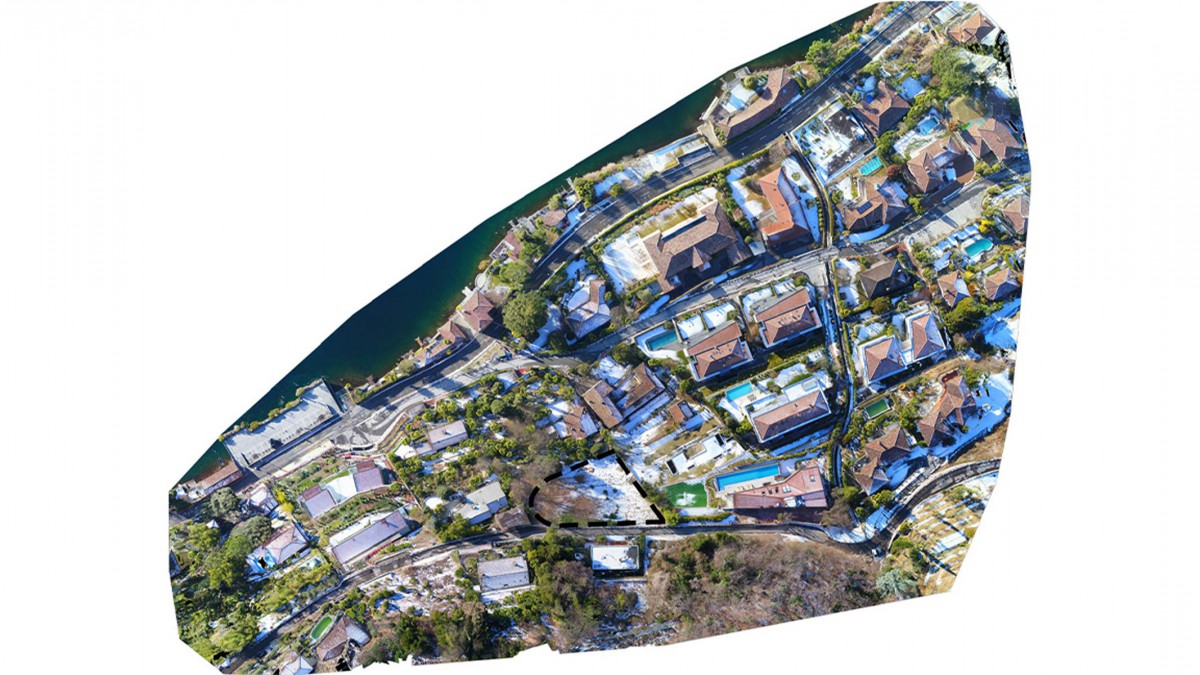
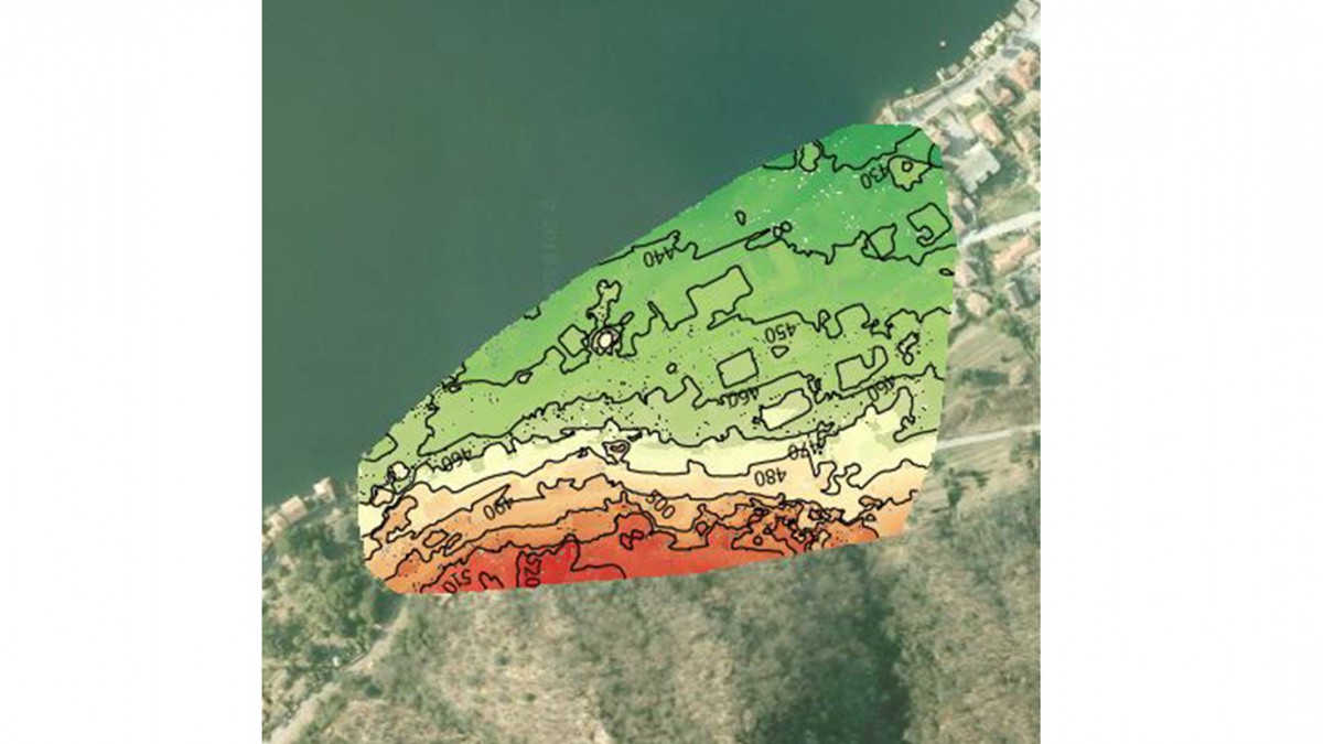
A technical study required a photogrammetry survey on a built area in view of construction of a new house. The survey should include the area involved in the project and the ambient context. The client needed to study distances from other buildings and window displays in order to have more details during the preliminary design phases of the new building.
Drone solution
The photogrammetry survey was carried out using a drone and 3 missions were carried out to cover whole area of interest. After acquiring the necessary photographs, we produced a detailed orthophoto of the area and an altimetric model of soil. We have provided the customer with a product that represents the situation on the actual state of survey area updated on the day of the survey. Thanks to these cartographic products, the customer was able to carry out the subsequent analyzes useful for the design.