Photogrammetry survey of quarry
- Drone Class B o superiore - DJI Mavic, Phantom o superiore
- Flight time 2 hour
- Post-production 48 hour
Customer
Mining companyProblem
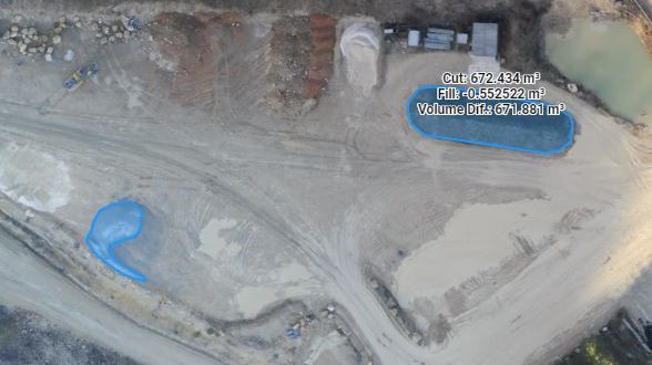
Mining companies must respect contractual requirements that limited the amount of extractable material. The failed respect of this obligation can give rise important legal responsabilities. In order to prevent this risk, companies want to produce supporting documentation.Drone Solution
Through a drone can be carried out photogrammetry surveys on the construction site area. In this way they are produced 3D models of soil, that allow measurement areas and volumes of single elements. Furthermore the models can be used for the creation of databases. The aerial monitoring carried out by drone allow to plan a periodic surveys quickly even with little notice.